|
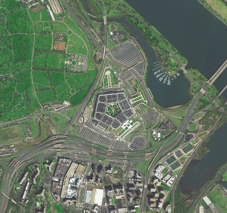
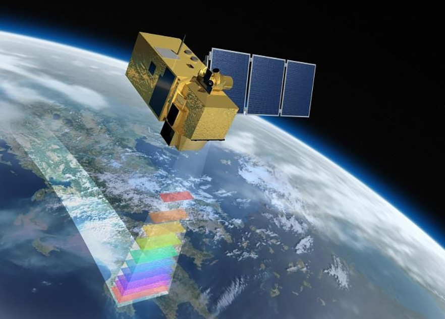
1. Satellite Imageries (1A,1B,2A Level)
|
|
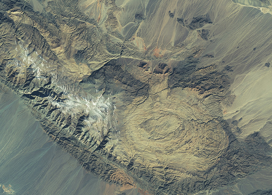
2. Orthophotomap
|
|
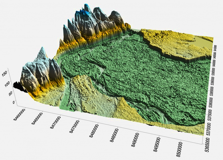
3. Mapmaking & 3-D Modelling
|
|
4. Spatial (Territorial) Development
|
|
1.
|
Photo plans, photo-schemes (industrial objects, villages, cities, agricultural territories).
|
ERS data
|
|
2.
|
Monitoring of infrastructure objects construction
|
ERS data
|
|
3.
|
Geospatial analysis of objects and territories functioning (retrospective review, analysis objects’ activity and the impact on the environment, development of urban and rural agglomerations).
|
ERS data
|
|
4.
|
Monitoring the implementation of spatial development plans.
|
ERS data
|
|
5. Agriculture
|
|
5.
|
Detecting land resources misuse.
|
Earth cadaster ERS data
|
|
6.
|
Normalized difference vegetation index (NDVI).
|
MODIS (TERRA)
|
|
7.
|
Normalized difference water index (NDWI).
|
MODIS (TERRA)
|
|
8.
|
Normalized Difference Snow Index (NDSI).
|
MODIS (TERRA)
|
|
9.
|
Land Surface Temperature.
|
MODIS (TERRA)
|
|
10.
|
Normalized-differential drought index (NDDI).
|
MODIS (TERRA)
|
|
11.
|
Index of Drought
|
MODIS (TERRA)
|
|
6. Road infrastructure
|
|
12.
|
Detecting vertical displacement of road surface (radar interferometry).
|
Sentinel-1
|
|
13.
|
Tracking road construction (or repair processes).
|
ERS data
|
|
7. Water resources
|
|
14.
|
Monitoring ice situation on seas and rivers.
|
ERS data
|
|
15.
|
Monitoring of shipping, ports and infrastructure conditions.
|
Sentinel-1, ERS data
|
|
16.
|
Monitoring of water objects status (river network, lakes).
|
Sentinel-1, ERS data
|
|
17.
|
Sea Surface Temperature
|
MODIS (TERRA)
|
|
18.
|
Water objects surface blooming
|
ERS data
|
|
8. Forestry
|
|
19.
|
Detecting the violations of forest management (illegal logging, lack of measures for restoration of logged lands).
|
ERS data
|
|
20.
|
Detecting temperature anomalies (fires) in forest soils across the country.
|
AVHRR (NOAA)
MODIS (TERRA)
VIIRS (SUOMI NPP)
|
|
21.
|
Forecasting fire hazardous areas
|
Meteorological data
|
|
9. Environmental Protection
|
|
22.
|
Monitoring the condition and activity of environmentally hazardous objects
|
ERS data, Meteorological data
|
|
23.
|
Analysis of man-made and natural disasters consequences (seasonal floods, floods, fires, explosions, hurricanes, etc.) across the country.
|
AVHRR (NOAA)
MODIS (TERRA)
VIIRS (SUOMI NPP)
|
|
24.
|
Water pollution with oil-products (seas,rivers)
|
Meteorological data
|
|
25.
|
Tracking climate change and its impact on environment
|
|
|
10. Crisis management (emergency situations)
|
|
26.
|
Identification of preconditions for emergencies.
|
ERS data, Meteorological data
|
|
27.
|
Monitoring the course and consequences of emergencies (fires, floods, storms, etc.).
|
ERS data, Meteorological data
|
|
28.
|
Monitoring the measures for localization of man-made and natural disasters consequences (restoration of territories and objects).
|
|
|
29.
|
Detecting temperature anomalies (fires) across the country.
|
AVHRR (NOAA)
MODIS (TERRA)
VIIRS (SUOMI NPP)
|
|
30.
|
Monitoring snow melting
|
MODIS (TERRA)
|
|
31.
|
Forecasting the probability of snow melting
|
Meteorological data (UHMI)
|
|
8. Meteorology
|
|
32.
|
Forecasting atmospheric precipitations using GIS
|
Meteorological data
|
|
33.
|
Forecasting meteorological drought using GIS
|
Meteorological data
|
|
34.
|
Forecasting fire hazardous areas using GIS
|
Meteorological data
|
|
9. Other services
|
|
35.
|
Possibility of ultra-high resolution (0,5-0,7 m) ultrasound data delivery to Ukrainian ground station in favor of state and commercial consumers.
|
Information in X-diapason
|
|
36.
|
Organizing and hosting of scientific and training conferences
|
|
|
37.
|
Conducting training sessions of ERD data processing
|
|
|
38.
|
ERS data thematic processing on customer’s request
|
|